WebProNews
Advertise with Us
🔥Firehose
Business
AccountingAI
AccountingTrends
AICxTrends
AutomotivePro
BizDevUpdate
BusinessCommunicationTrends
CallCenterPro
CAOTrends
CCOPro
CEOTrends
CFOTrends
CloudWorkPro
CMSPro
COOUpdate
CPOTrends
CustomerExperienceNews
GlobalWorkforceInsights
EmployeeExperiencePro
ENTBusinessNews
EnterpriseWebPro
FinanceAI
FinancePro
HRProNews
InsideOffice
InternalCommsPro
LocalSearchPro
PayrollPro
ProcurementPro
ProductManagementPro
RemoteWorkingTrends
RiskManagementPro
SAASPro
SalesEnablementTrends
SalesTechPro
SmallBusinessNews
SmallBusinessUpdate
SmallSiteNews
SmallWebBusiness
WebProBusiness
WebsiteNotes
IT Management
AISecurityPro
AppSecurityUpdate
BigDataPro
CDOPro
CIOProNews
CISOUpdate
CloudPlatformPro
CloudSecurityUpdate
CSOPro
CTOUpdate
CybersecurityUpdate
DataAnalystPro
DatabaseProNews
DevSecOpsPro
EnterpriseITPro
EnterpriseSecurity
InfoSecPro
ITManagementNews
ITProNews
LowCodeUpdate
MultiCloudPro
NetSecPro
NetworkingFiles
NetworkNews
SecurityProNews
SOCUpdate
SREupdate
SysAdminNews
ZeroTrustPro
Developer
AIDeveloper
AppDevNews
CloudOpsPro
DesignNews
DevNews
DevOpsUpdate
DevSecurityPro
DevWebPro
FinOpsUpdate
KubernetesPro
MobileDevPro
ObservabilityTrends
PlatformEngineerPro
SoftwareEngineerNews
Emerging Tech
5GRevolution
AgenticAI
AutoRevolution
AITrends
ChinaRevolutionUpdate
CloudRevolutionUpdate
CompliancePro
CryptocurrencyPro
EdgeComputingPro
EdTechUpdate
ElectricVehicleTrends
EmergingTechUpdate
FinTechUpdate
GenAIPro
HiTechEdge
HealthRevolution
HealthcareITPro
IoTUpdate
MachineLearningPro
MobilityRevolutionUpdate
RideShareRevolution
TransportationRevolution
RobotRevolutionPro
SpaceRevolution
VirtualRealityTrends
Advertising & Marketing
AdTechPro
AdvertisingDay
AdvertisingSmallBiz
AnalyticsPro
AppProductPro
B2BMarketingTrends
BrandBuildingPro
CDOUpdate
CDPTrends
CMOTrends
CMSPro
ContentMarketingNews
CRMNews
CROTrends
DigitalAgencyPro
DemandGenPro
DataDrivenMarketingPro
DAMPro
DigitalExperiencePro
DigitalMarketingNews
DigitalTransformationTrends
EmailMarketingToday
EnterpriseCRMNews
EnterpriseMarketingNews
EnterpriseSalesNews
FullStackMarketerNews
InfluencerMarketingPro
InsightEdge
MarketingAI
MarTechPro
MarketingNews
MarketingStrategiesPro
MediaTransformationUpdate
MOPSPro
OmniChannelMarketer
PodcastingPro
ProgrammaticAdvertisingPro
PublicRelationsPro
RevOpsPro
SalesNews
SearchNews
SEOProNews
SocialMediaNews
UGCTrends
VideoMarketingPro
Retail & eCommerce
B2BeCommerce
CPGTrends
EcommerceMarketing
DigitalCommerceNews
DTCTrends
EcommerceTrends
eCommNews
EnterpriseCustomer
EnterpriseECommerce
FutureRetailNews
LogisticsPro
ManufacturingPro
MarketplaceCommerce
MobileCommercePro
PaymentTrends
RestaurantRevolution
RetailConvergence
RetailMarketingPro
RetailPro
RetailRevolution
SharingEconomyTrends
SubscriptionEconomyPro
SupplyChainPro
🔥Firehose
Browse Categories
Business
IT Management
Developer
Emerging Tech
Advertising & Marketing
Retail & eCommerce
Home
Contact Us
Privacy Policy
Advertise With Us
Newsletter Signup
Request Media Kit
Tag: map
Life
Tunnels Under Rome Being Mapped to Prevent Further Damage to City
- December 3, 2013
IT Management
Gain A New Appreciation For The Internet By Checking Out This Underwater Cable Map
- February 4, 2013
IT Management
Forget Tubes, The Internet Is More Like The Universe
- July 25, 2012
Life
Game of Thrones Minecraft Project Maps King’s Landing
- March 2, 2012
SocialMediaNews
Facebook Has Mapped Status Updates Relating To Disaster In Japan
- March 14, 2011
Recent Articles
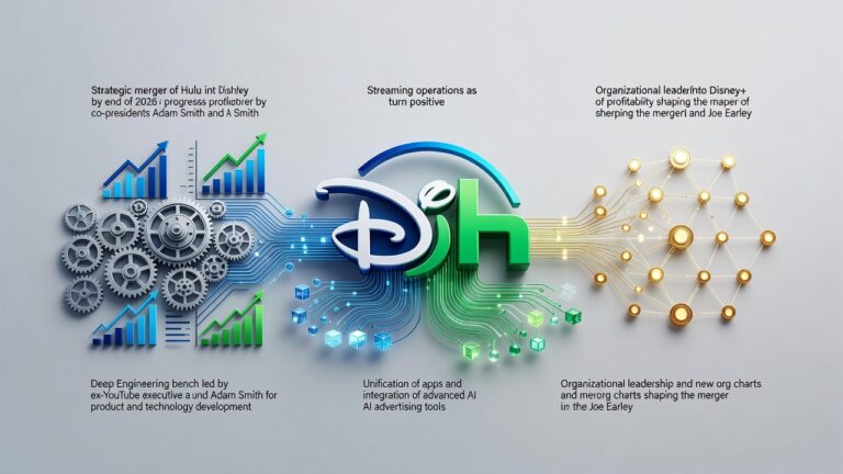
Disney’s Streaming Power Shift: How Ex-YouTube Executive Adam Smith Steers Hulu’s Merger Into Disney+
Sunday, July 5, 2026
Meta’s Secret Push to Break Rival Chatbots: Contractors Posed as Kids to Feed Disturbing Prompts
Sunday, July 5, 2026
Bitcoin’s Brutal Slide: A 20% Rout Tests Holders as Macro Forces and Corporate Sales Bite
Sunday, July 5, 2026
Get the WebProNews newsletter delivered to your inbox
Get the
free daily newsletter
read by decision makers
Subscribe
Advertise with Us
Ready to get started?
Get our media kit
Advertise with Us
[forminator_form id="2543"]