
NASA has marked a significant milestone by releasing a collection of breathtaking images from Mars, celebrating two decades since one of its key spacecraft began orbiting the Red Planet. This event highlights the enduring success of the Mars Reconnaissance Orbiter, which has provided invaluable data and visuals that continue to shape our understanding of Martian geology, climate, and potential for past life. The images, captured over years of operation, showcase diverse landscapes from towering volcanoes to intricate dune fields, offering a fresh perspective on the planet’s dynamic surface.
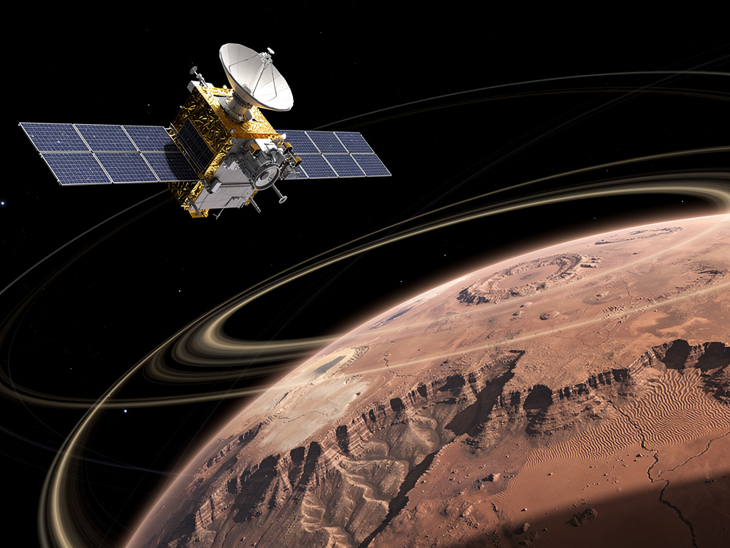
The orbiter, launched in 2005 and entering Mars’ orbit in 2006, has far exceeded its initial mission expectations. Designed to study the planet’s atmosphere, search for signs of water, and scout landing sites for future rovers, it carries a suite of advanced cameras and sensors that have revolutionized planetary science. Among the standout instruments is the High Resolution Imaging Science Experiment, or HiRISE, capable of resolving features as small as a meter across from hundreds of kilometers above the surface. This tool has produced some of the most detailed pictures ever taken of another world, revealing layered rock formations, impact craters, and evidence of ancient riverbeds.
In commemoration of this anniversary, NASA shared several notable images that capture the essence of Mars’ varied terrain. One striking example depicts the vast Olympus Mons, the largest volcano in the solar system, its slopes etched with lava flows frozen in time. Another shows the intricate patterns of sand dunes in the planet’s southern hemisphere, where winds sculpt ever-changing shapes that mimic earthly deserts but on a grander scale. These visuals not only captivate the public but also serve as critical data points for researchers analyzing seasonal changes and atmospheric interactions.
As detailed in a recent report from Digital Trends, the agency highlighted how the orbiter’s longevity stems from careful engineering and adaptive mission management. Engineers at NASA’s Jet Propulsion Laboratory have monitored the spacecraft’s health, adjusting its orbit to conserve fuel and extend its operational life. This approach has allowed it to support multiple surface missions, including relaying communications from rovers like Curiosity and Perseverance back to Earth. Without such orbital assets, exploring Mars would be far more challenging, as they provide real-time oversight and high-bandwidth data transfer.
To appreciate the orbiter’s impact, consider its role in uncovering Mars’ watery past. Early in its mission, it detected vast deposits of clay minerals, which form in the presence of water, suggesting that liquid once flowed abundantly on the surface. Images from HiRISE revealed gullies that appear to have been carved by recent water activity, though debates persist about whether these result from melting ice or dry landslides. Such findings have prompted scientists to revise models of the planet’s climate history, indicating a warmer, wetter era billions of years ago that could have supported microbial life.
Beyond geology, the orbiter has monitored Mars’ thin atmosphere, tracking dust storms that can engulf the entire planet. One memorable image series captured a massive storm in 2018, which shrouded the surface and temporarily halted operations for the Opportunity rover. By studying these events, researchers gain insights into atmospheric dynamics, including how dust influences temperature and wind patterns. This knowledge is essential for planning human missions, as astronauts would need to contend with such unpredictable weather.
The spacecraft’s Context Camera, or CTX, provides broader views that complement HiRISE’s close-ups, covering swaths of terrain to map global features. Together with the Compact Reconnaissance Imaging Spectrometer for Mars, or CRISM, which analyzes mineral compositions through infrared light, these tools have identified potential resources like subsurface ice that could sustain future explorers. For instance, CRISM data pinpointed hydrated salts in recurring slope lineae, dark streaks that appear seasonally and might indicate briny flows.
Over 20 years, the orbiter has transmitted more than 400 terabits of data, equivalent to streaming thousands of high-definition movies. This wealth of information has fueled countless scientific papers and inspired new generations of space enthusiasts. Public engagement efforts, such as NASA’s online galleries, allow anyone to explore these images, fostering a sense of connection to distant worlds.
Looking ahead, the orbiter’s continued operation supports ongoing and upcoming missions. It has scouted sites for the Mars Sample Return campaign, where Perseverance is collecting rock cores for eventual return to Earth. By providing detailed reconnaissance, it helps ensure safe landings and efficient exploration paths. Moreover, its data integrates with observations from other orbiters like MAVEN, which focuses on atmospheric escape, and the European Space Agency’s Mars Express, creating a comprehensive picture of the planet’s evolution.
The engineering behind this endurance deserves recognition. The spacecraft’s solar panels, though aged, still generate sufficient power, and its propulsion system has executed precise maneuvers to maintain orbit. Challenges, such as radiation exposure and component wear, have been managed through redundant systems and software updates sent from Earth. This resilience underscores the value of investing in long-term missions that yield compounding returns over time.
In terms of visual artistry, the images often resemble abstract paintings, with reds, oranges, and blacks dominating the palette. One anniversary release features the Nili Fossae region, a fractured terrain rich in minerals that hint at hydrothermal activity in the past. Another showcases the polar ice caps, where layers of frozen carbon dioxide and water ice record climatic cycles much like tree rings on Earth. These depictions not only advance science but also spark imagination, reminding us of Mars’ alien beauty.
Scientists have used orbiter data to model the planet’s interior, inferring a liquid core from subtle gravitational variations. This contributes to theories about why Mars lost its magnetic field, leading to atmospheric stripping by solar wind. Such models help explain the divergence between Earth and Mars, two planets that started similarly but followed different paths.
The mission has also facilitated international collaboration. Data from the orbiter is freely available through NASA’s Planetary Data System, enabling researchers worldwide to analyze and interpret findings. This open access has led to discoveries like underground lava tubes, potential shelters for future habitats, identified through thermal imaging.
As Mars exploration progresses, with plans for crewed missions in the 2030s, the orbiter’s legacy will endure. It has paved the way for technologies like high-resolution imaging that could be adapted for other celestial bodies, such as Jupiter’s moon Europa or Saturn’s Enceladus. The knowledge gained about Martian dust and radiation informs spacecraft design, ensuring safer journeys for astronauts.
Reflecting on two decades of achievement, the orbiter stands as a testament to human ingenuity in space exploration. Its images, shared widely, bridge the gap between scientific inquiry and public wonder, inviting everyone to ponder the mysteries of our neighboring planet. Through persistent observation, it has transformed abstract concepts into tangible evidence, enriching our collective understanding of the cosmos.
The anniversary celebration also prompts consideration of future orbital missions. Concepts like the Mars Ice Mapper aim to build on this foundation, focusing on water resources essential for sustained human presence. By combining radar and imaging, such endeavors could reveal hidden aquifers or ice reserves, expanding the possibilities for colonization.
In educational contexts, these images serve as powerful tools. Schools and museums incorporate them into curricula, teaching students about planetary science and remote sensing. Virtual reality experiences based on orbiter data allow immersive tours of Mars, enhancing learning and inspiring careers in STEM fields.
Economically, the mission has spurred innovations in aerospace technology, from improved batteries to radiation-hardened electronics, with applications in terrestrial industries like telecommunications and renewable energy. The orbiter’s success demonstrates the broader benefits of space investment, driving progress across multiple sectors.
Ultimately, as NASA continues to release and analyze data from this veteran spacecraft, the story of Mars unfolds further. Each image adds a chapter, revealing a world that, while harsh and unforgiving, holds clues to universal questions about life, habitability, and the origins of planets. The 20-year mark is not an endpoint but a waypoint in an ongoing saga of discovery, propelled by the unyielding gaze of a machine that has become our eyes on the Red Planet.

