
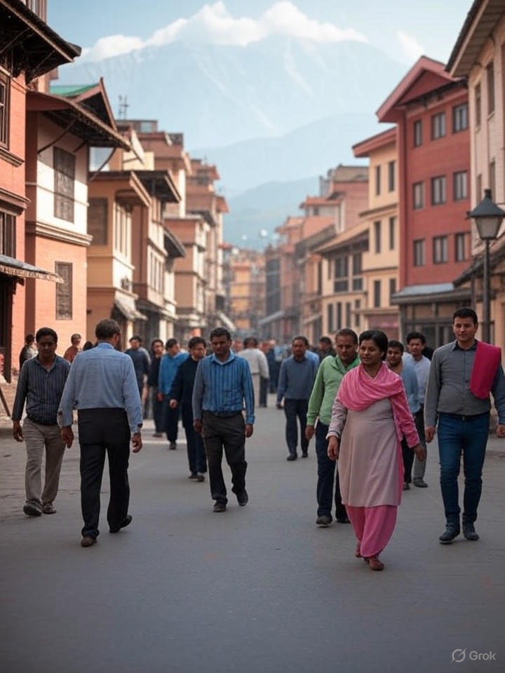
In a move that expands digital access to one of the world’s most remote and culturally rich regions, Google has officially launched Street View coverage in Nepal, allowing users worldwide to virtually traverse the bustling streets of Kathmandu and beyond. The announcement, detailed in a post on Google’s official blog, marks a significant milestone after years of anticipation and sporadic sightings of mapping vehicles. This rollout builds on Google’s earlier efforts, such as the 2015 Street View Trek in the Khumbu region, which captured immersive views of the Everest area through partnerships with local climbers like Apa Sherpa.
The new coverage encompasses major urban centers and select rural areas, providing 360-degree imagery that lets users explore temples, markets, and mountain paths from their devices. According to the blog, the initiative involved deploying specialized vehicles equipped with high-resolution cameras to navigate Nepal’s diverse terrain, overcoming challenges like rugged roads and high altitudes.
From Speculation to Reality: The Path to Launch
Speculation about Nepal’s inclusion in Street View has simmered for months, fueled by online communities. Posts on Reddit’s r/geoguessr subreddit, including one from June 2024 highlighting a “shitcam car” spotted in Kathmandu, sparked debates about image quality and official confirmation. By August 2025, excitement peaked with another Reddit thread announcing the impending arrival, garnering over 100 votes and comments from geography enthusiasts eager for new virtual exploration opportunities.
On X (formerly Twitter), users like Virtual Streets shared updates as early as October 2024, noting Google’s list of planned coverage across Nepal’s provinces, excluding Karnali, with imagery captured from May to December 2024. A more recent post from Ai Tool Hub on August 15, 2025, celebrated the launch, emphasizing its potential for geotagging and cultural discovery, while aakar highlighted the technological innovation in real-time.
Technological Hurdles and Innovations
Despite the enthusiasm, early concerns about camera quality persist. The Reddit discussions pointed to potential “badcam” issues, where imagery might appear low-resolution or distorted, a common challenge in regions with variable infrastructure. Google’s blog addresses this indirectly by touting advancements in mapping technology, including AI-enhanced processing to refine views in challenging environments.
This isn’t Google’s first foray into Nepal; a decade ago, as reported by TechCrunch in March 2015, the company partnered with nonprofits to map the Everest region, resulting in virtual tours that included monasteries and yak pastures. That project, also covered by CBS News, demonstrated Google’s commitment to blending technology with local expertise, a strategy echoed in the current expansion.
Implications for Tourism and Local Economies
The launch could transform how global audiences engage with Nepal, potentially boosting tourism by offering previews of sites like Durbar Square or the Annapurna trails. Industry insiders note that Street View has historically driven visitor interest in other destinations, with studies from sources like Mashable in 2015 showing increased online searches following similar rollouts.
For Nepalese businesses, the feature integrates with Google Maps’ ecosystem, enabling better navigation and visibility. As detailed in a recent article on ICT Frame, published just hours ago, users can now book metro tickets or find EV stations in select areas, though Nepal’s update focuses more on visual exploration than these urban tools.
Broader Context in Global Mapping
Google’s push into Nepal aligns with broader trends in digital cartography, where companies race to cover underserved areas amid privacy and data sovereignty debates. In Nepal, this comes against a backdrop of past border mapping controversies, as seen in 2020 X posts from PHALANO urging updates to reflect official territorial claims.
Looking ahead, experts anticipate further enhancements, such as 3D modeling integration mentioned in community forums like Google Maps Help threads from 2021. While the current rollout is comprehensive, gaps in remote provinces suggest room for expansion, potentially involving drone or backpack-based imaging.
Community Reactions and Future Prospects
Reactions on X have been overwhelmingly positive, with users like Marcus noting the timely release alongside other global updates. This sentiment echoes in The Indian Express coverage of Nepal-related news, which often highlights technological integrations as economic catalysts.
Ultimately, Google’s Street View in Nepal represents more than just pixels on a screen—it’s a bridge between isolated communities and the digital world, fostering education, commerce, and cultural exchange in an era of rapid tech evolution. As mapping innovations continue, this launch sets a precedent for inclusive global coverage.

