

Google Earth is meant to give its users a realistic view of the world, and the program by and large accomplishes that. A new upgrade will make it even more accurate, though, by showing users whether or not they’d be getting wet if they were to visit certain parts of the globe.
Yes, Google Earth 5.2 is now supposed to account for both rain and snow – everything "from light drizzle and snow to hurricanes and blizzards," in fact – at least in some regions of North America and Europe.
As for how a person can take advantage of the new feature, it’s not at all complicated. Software engineer Quarup Barreirinhas explained on the LatLong Blog, "First enable the clouds layer, then zoom in to a particular location where it might be raining or snowing." (You check out the radar layer to see what’s covered if guesswork isn’t your thing.)
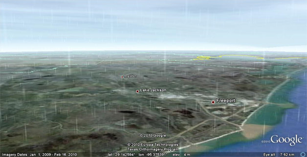
Zoom in far enough, and you’ll be able to see something like the image below, which was captured/generated around the time Hurricane Alex was passing into Texas.
Travelers and people who are weighing a move – along with folks who just enjoy interesting graphics – are sure to appreciate this information.
Maybe only weathermen will object to the development, since Google Earth is starting to represent a pretty decent alternative to watching the local forecast.

