Google Adds GeoEye Layer to Earth, Zoo to Maps
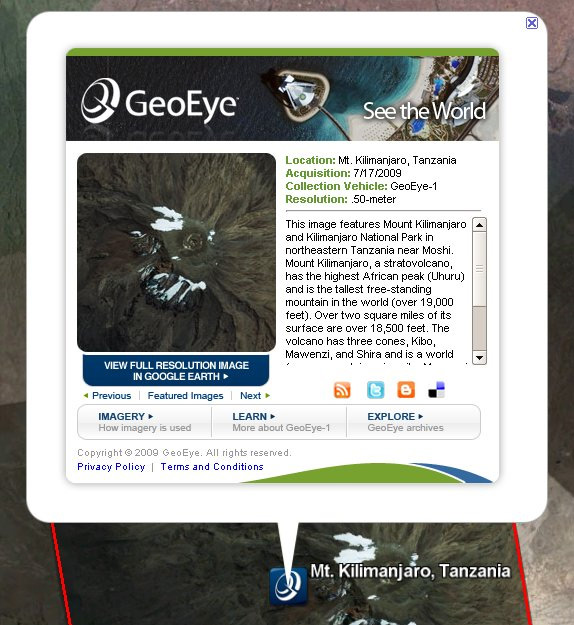
If you are not familiar with GeoEye, it's the company behind the GeoEye-1 satellite. This is a satellite with a very high-resolution camera on it that takes pictures of the world, and Google uses imagery from that in Google Earth and Google Maps.
Chris Crum